Welcome to Nairr Sandbox Workspaces
0
Advancing US Innovation in Artificial Intelligence
The NAIRR Pilot aims to connect U.S. researchers and educators to computational, data, and training resources needed to advance AI research and research that employs AI. Check out the sandbox workspaces and education models below.
Sandbox Workspaces
NAIRR Pilot Sandbox projects are for anyone interested in exploring AI related allocation. These sandboxes are isolated environment used for experimentation and development, separate from the main production environment. It allows academics, scientist and students to try out new features, try out server configurations, or play with AI tools without impacting the live system. Think of it as a playground where you can play with different tools and ideas without breaking anything that's already working.
The following NAIRR Pilot projects have datasets within the National Data Platform.
HydroGEN: National Hydrology AI Digital Twin Pilot
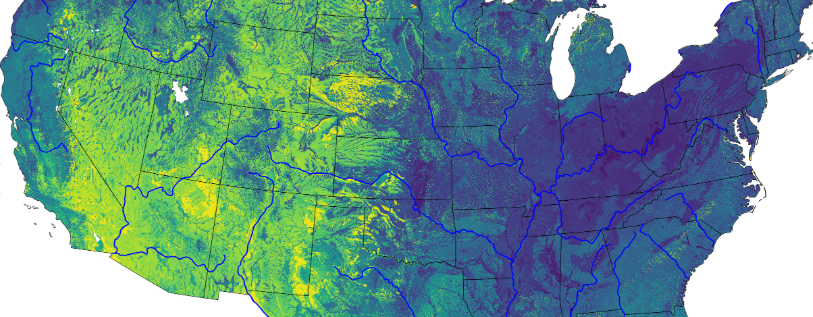
Company: Hydroframe
We aim to build the first digital twin of the complete terrestrial hydrologic cycle from bedrock to treetops across the United States. Once developed, the model can be continuously updated and improved with new information from remote sensing products and gauge observations. Our digital twin will generate monthly national forecasts in real time daily, and all outputs will be publicly hosted and freely accessible. Demo Project Page
OpenTopography: Digital Elevation Model Data
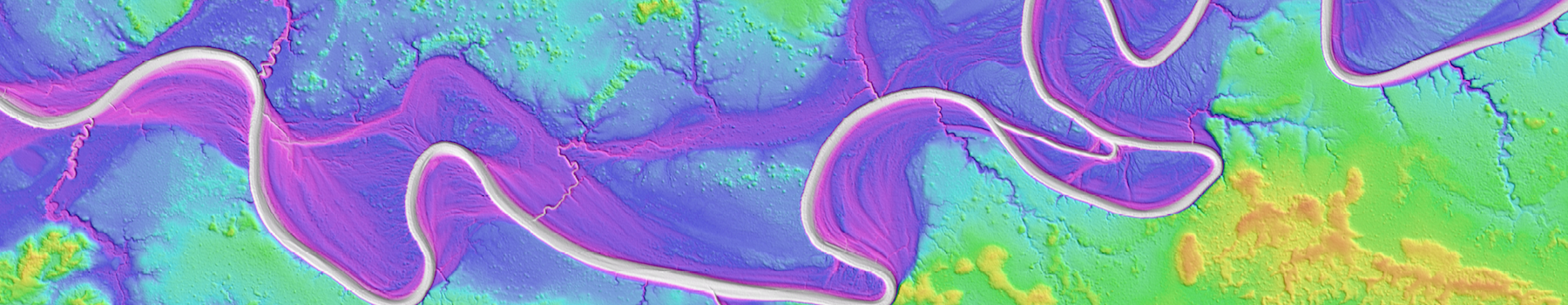
OpenTopography facilitates community access to high-resolution, Earth science-oriented topography data and related tools and resources. OpenTopography is supported by the National Science Foundation under Award Numbers 2410799, 2410800, & 241080.
OpenTopography-hosted high-resolution raster topography datasets have been selected for integration into the National Science Foundation's (NSF) National Artificial Intelligence Research Resource (NAIRR) Pilot Program. News Page
NAIRR pilot resources page (Available open data and models). Open Data Page
Education Hub
Resources can be given to US based educators and researchers who are teaching undergraduate or graduate courses or shorter duration training sessions to US based students that include subject matter in artificial intelligence and require that students use advanced computational resources as part of their coursework. Courses from any discipline are eligible for this program.
Leverage the National Data Platform to create educational modules for students. An example is provided below:
Fire-Ready Forests Data Challenge
An open data challenge focused on advancing the prediction of tree species, height, location, and other critical forest metrics. The goal is to improve the accuracy of 3D physics-based fire models in simulating fire behavior and its ecological effects.
Datasets: FastFuels, FIA Database, ALS, TLS and observed field data.
Learn more about NAIRR
Explore sandbox projects and additional resources available through the NAIRR Pilot program.